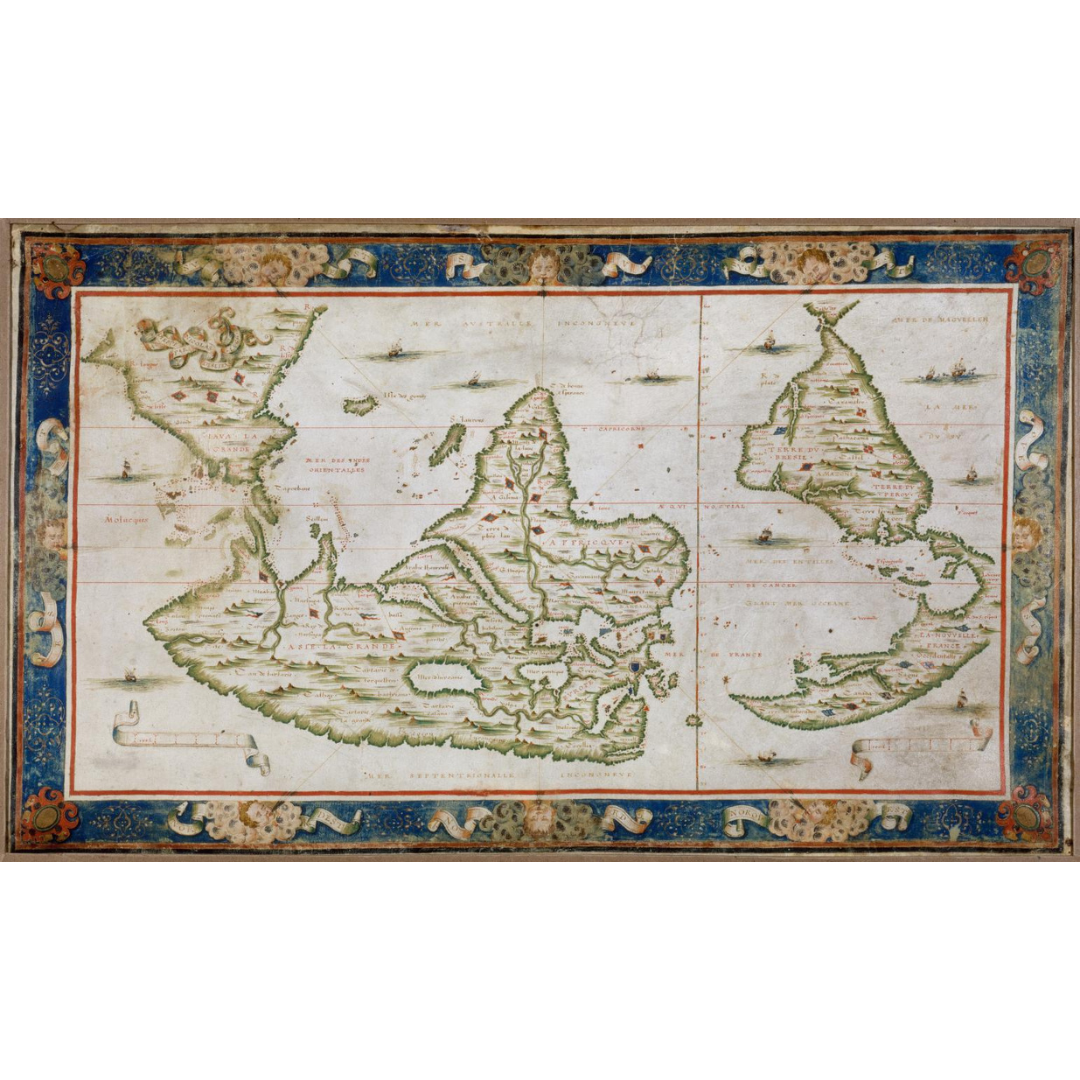


A striking portolan world map drawn in 1566 by Nicolas Desliens, synthesizing Norman hydrographic knowledge of the mid-16th century. Oriented with south at the top, it presents a compelling “upside-down” worldview and marks newly claimed lands with French fleurs-de-lis. Across an arc-shaped North America appears the bold label La Nouvelle France occidentalle (Western New France).
Features / Details
-
Cartographer: Nicolas Desliens (active 1541–1566)
-
Date: 1566
-
Map Type: Portolan nautical chart; manuscript in color on vellum
-
Orientation: South at the top (north at the bottom)
-
Geographic Coverage: World (most of the Pacific not shown; part of the west coast of North America extends beyond the sheet)
-
Notable Historical Labels & Marks: “La Nouvelle France occidentalle” over North America; French claims indicated by fleurs-de-lis in Canada (Labrador), Florida (May River), and Brazil (Rio de la Plata)
-
Physical Details (original): 1 map; 27 × 45 cm
-
Language: French
-
Publication Info (original): Place and publisher not identified
-
Provenance: Original resource at the National Library of France
Source & Rights
Image courtesy of the Library of Congress.
You will receive a newly made, high-resolution fine-art print of this historical map (not the original artifact).