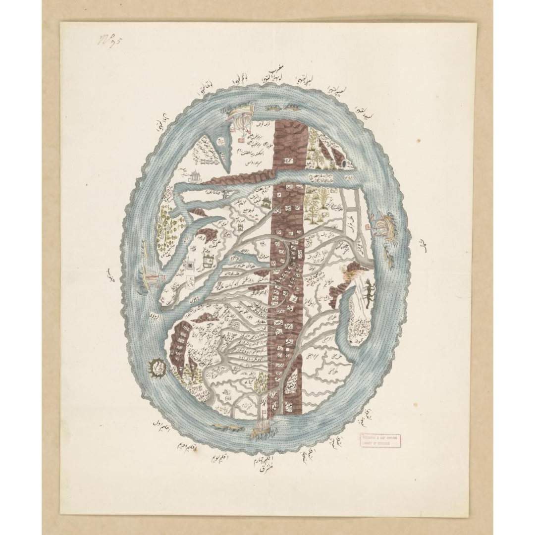


A rare pictorial manuscript map of the Islamic world, created around 1790, likely in South Asia. Drawn in pen, ink, and watercolor, it presents a conceptual geography that foregrounds the Middle East with extensions into Central and South Asia, and even depicts the legendary land of Gog and Magog—an evocative feature of early Islamic and world cartography.
Features / Details
-
Date: c. 1790
-
Map Type: Pictorial manuscript map (pen, ink, and watercolor)
-
Regions Covered: Middle East; Central Asia; South Asia
-
Notable Features: Conceptual Islamic world layout; inclusion of Gog and Magog
-
Genre/Period: Early map; manuscript
-
Publication Info (original): Producer and place not identified
-
Title Source: Supplied by cataloger
Source & Rights
Image courtesy of the Library of Congress.
You will receive a newly made, high-resolution fine-art print of this historical map (not the original artifact).