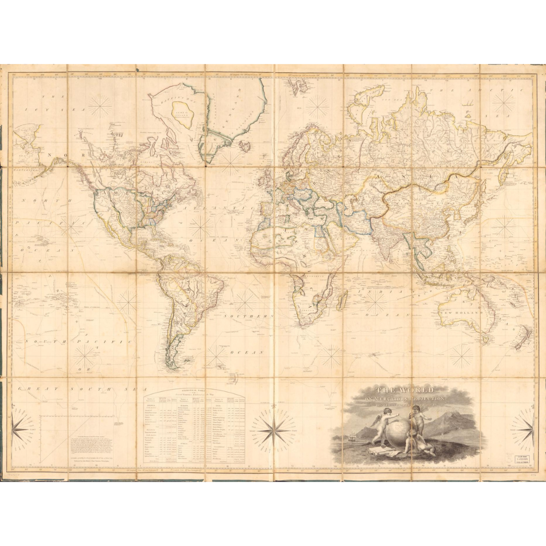


A large hand-colored world map published in Philadelphia in 1817 on Mercator’s projection. It reflects early-19th-century geographic knowledge with pictorial relief, practical navigation guidance, and a statistical table—combining elegance with utility for contemporary readers.
Features / Details
-
Date: 1817
-
Projection: Mercator
-
Place of Publication (original): Philadelphia
-
Publishers (original): John Melish & Samuel Harrison
-
Contributors (cartouche): H. Bridport (delineavit); G. Murray (sculpsit)
-
Scale (original): ca. 1:33,000,000
-
Relief: Shown pictorially
-
Coloring: Hand colored
-
Physical Format (original): Sectioned and mounted on cloth backing
-
Additional Content: Text “To find the distance of one place from another” and a statistical table
-
Map Type: World map
Source & Rights
Image courtesy of the Library of Congress.
You will receive a newly made, high-resolution fine-art print of this historical map (not the original artifact).