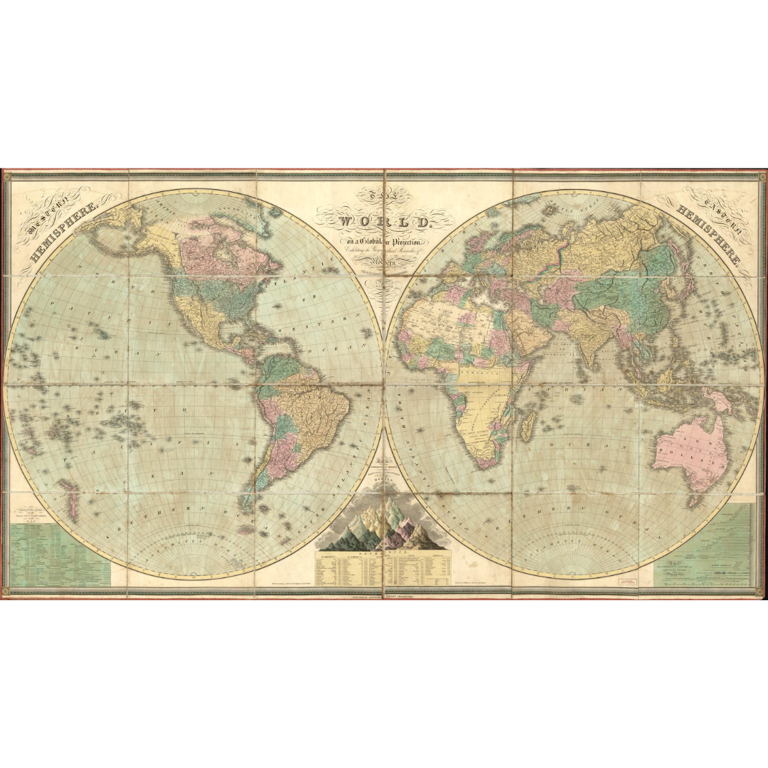


An 1826 world map published in Philadelphia by Anthony Finley, drawn on a globular projection to showcase the era’s latest geographic discoveries. Relief is rendered pictorially, and the sheet features comparative graphics of the highest mountains and longest rivers by continent—blending exploration-era data with an elegant visual style.
Features / Details
-
Date: 1826
-
Projection: Globular
-
Place of Publication (original): Philadelphia
-
Publisher (original): Anthony Finley
-
Creator: D. H. Vance
-
Relief: Shown pictorially
-
Notable Additions: Statistics and illustrations comparing the world’s highest mountains and longest rivers (by continent)
-
Physical Format (original): Sectioned into 24, mounted on cloth for folding; two marbled covers affixed to verso
-
Map Type: World map
Source & Rights
Image courtesy of the Library of Congress.
You will receive a newly made, high-resolution fine-art print of this historical map (not the original artifact).