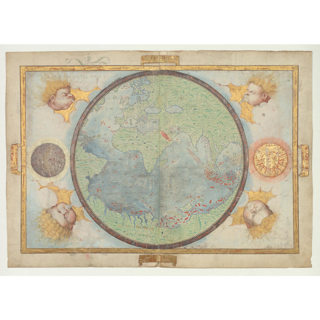


A richly illuminated hemispheric world map from the Miller Atlas, produced in 1519 for King Manuel I of Portugal by Pedro Reinel, Jorge Reinel, and Lopo Homem, with miniatures by António de Holanda. Focused on the Portuguese sphere defined by the Treaty of Tordesillas, it presents the “known world” of the early 16th century in a circular composition, accompanied by a Latin title page bearing Catherine de’ Medici’s coat of arms and crediting Lopo Homem in Lisbon.
Features / Details
-
Cartographers/Artists: Pedro Reinel; Jorge Reinel; Lopo Homem (cartographers); António de Holanda (miniaturist)
-
Patron: King Manuel I of Portugal (1469–1521)
-
Date: 1519
-
Map Type: Illuminated mappa mundi / world map focused on the Portuguese hemisphere
-
Historical Context: Shows only territory allocated to Portugal under the 1494 Treaty of Tordesillas
-
Inscription: Latin text credits Lopo Homem and states the work was drawn in Lisbon in 1519, collating ancient and recent maps
-
Physical Details (original): 1 map, 4 pages, on vellum with illustrations; 59 × 41.5 cm; originally part of an atlas of eight maps on six sheets
-
Language: Latin
-
Publication Info (original): Place and publisher not identified
-
Provenance: Miller Atlas; original held at the National Library of France
Source & Rights
Image courtesy of the Library of Congress.
You will receive a newly made, high-resolution fine-art print of this historical map (not the original artifact).