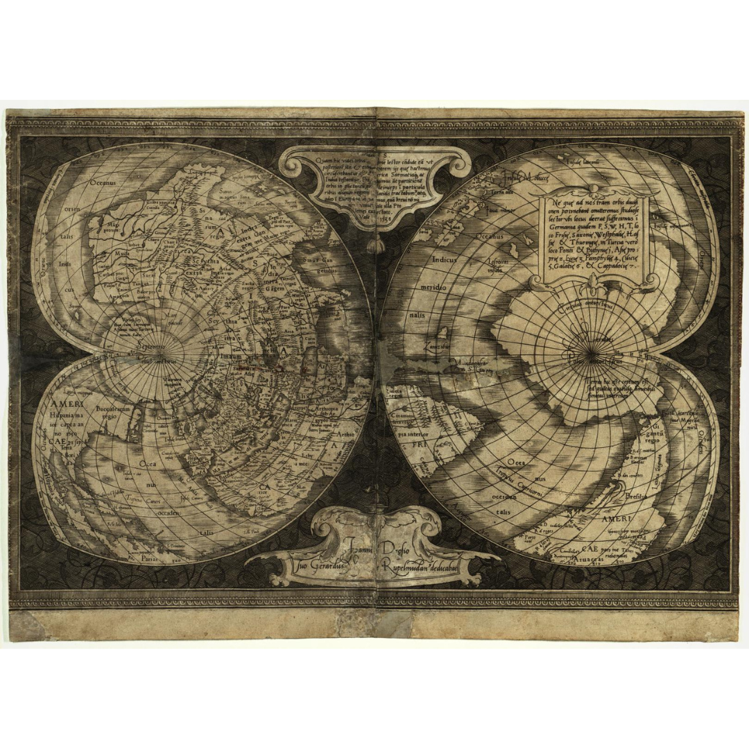


An early masterpiece by Gerardus Mercator, this 1538 world map uses a striking double–heart (cordiform) projection to portray the globe with unusual clarity. It is among the first maps to apply the name “America” to both North and South America and to distinguish them as separate continents—an influential step in Western cartography.
Features / Details
-
Cartographer: Gerardus Mercator (1512–1594)
-
Date: 1538
-
Projection: Double cordiform (two heart-shaped hemispheres)
-
Map Type: World map
-
Notable: Early use of “America” for both North & South America; separates the continents
-
Scale (original): 1:65,000,000
-
Physical details (original): 1 map; two hemispheres, each 31 cm diameter, on sheet 46 × 61 cm
-
Language: Latin
-
Publication info (original): Place and publisher not identified
-
Provenance: Original resource at University of Wisconsin–Milwaukee Libraries
Source & Rights
Image courtesy of the Library of Congress.
You will receive a newly made, high-resolution fine-art print of this historical map (not the original artifact).