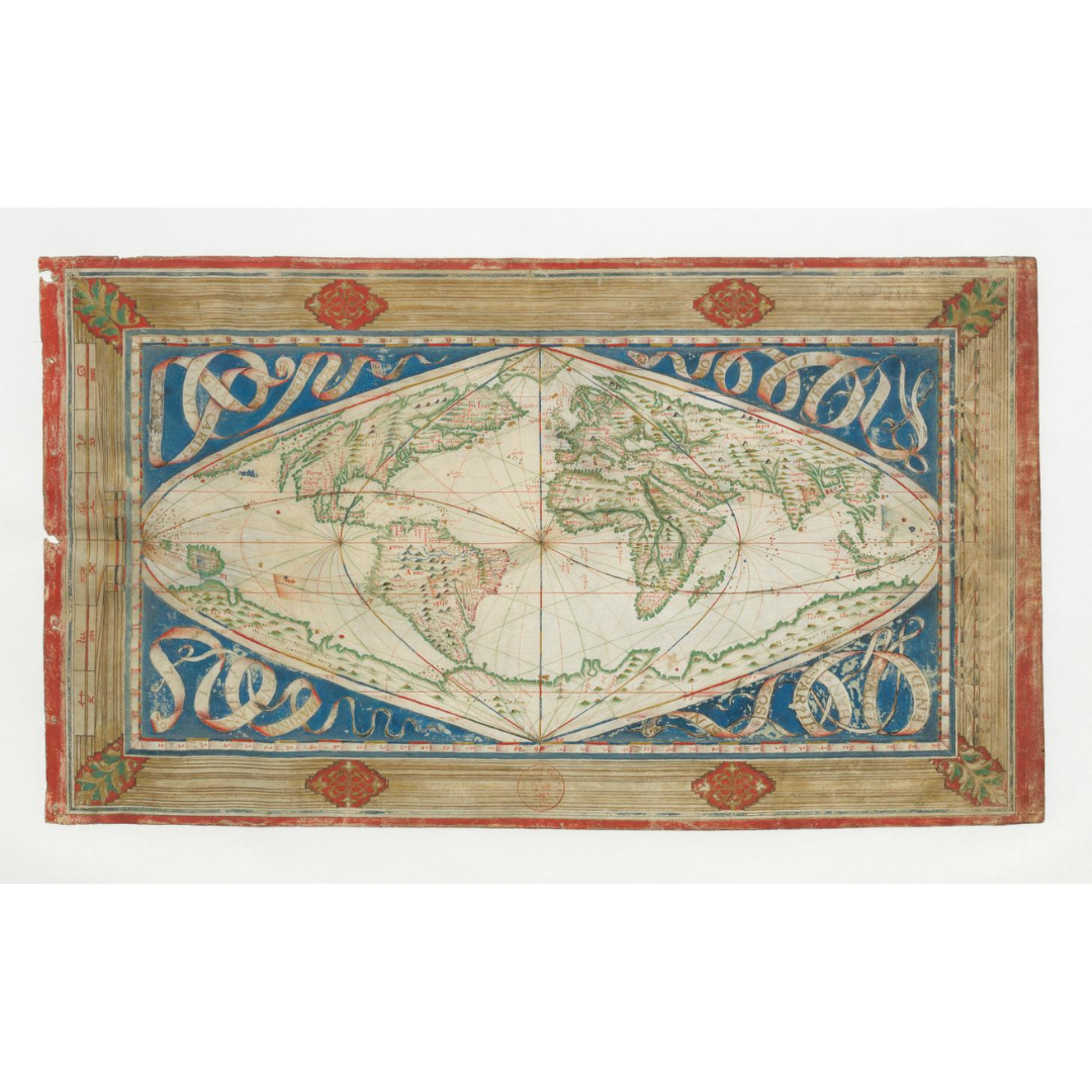


An extraordinary 1570 world map from Dieppe that employs a rare sinusoidal projection and traces prevailing winds across the globe. Thought to be the only surviving map by Jean Cossin, it pairs advanced mathematical cartography with rich manuscript decoration, including zodiac and climate panels and a hypothesized southern continent unfurling from Tierra del Fuego.
Features / Details
-
Date: 1570
-
Projection: Sinusoidal (meridians as sinusoids; equidistant straight-line parallels)
-
Map Type: World map with wind paths; manuscript on vellum
-
Place of Production (original): Dieppe, France
-
Cartographer: Jean Cossin
-
Notable Features: Vast southern continent (Terra Australis hypothesis); zodiac along left frame; climates along right; corner banners naming title, author, date, and place
-
Physical Details (original): 1 manuscript map, color, on vellum; 25 × 43 cm
-
Language: French
-
Publication Info (original): Publisher not identified
-
Provenance: Original resource at the National Library of France
Source & Rights
Image courtesy of the Library of Congress.
You will receive a newly made, high-resolution fine-art print of this historical map (not the original artifact).