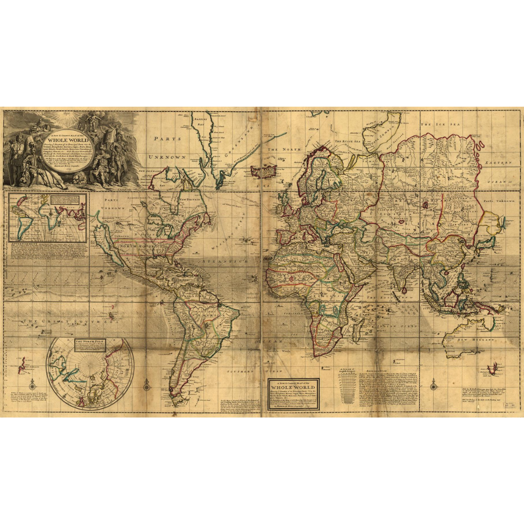


An early-18th-century world map published in London in 1719 under the title A new & correct map of the whole World. This engraved sheet exemplifies the clear, information-forward style of British atlases of the period and circulated in at least two issues—one notably showing colonial “sea-to-sea” grants in North America.
Features / Details
-
Date: 1719
-
Place of Publication (original): London
-
Map Type / Genre: World map; early work to 1800
-
Original Title: A new & correct map of the whole World
-
Edition Notes: Two issues recorded; one issue depicts colonial sea-to-sea grants in North America
-
Cartographer: Herman Moll (d. 1732)
Source & Rights
Image courtesy of the Library of Congress.
You will receive a newly made, high-resolution fine-art print of this historical map (not the original artifact).