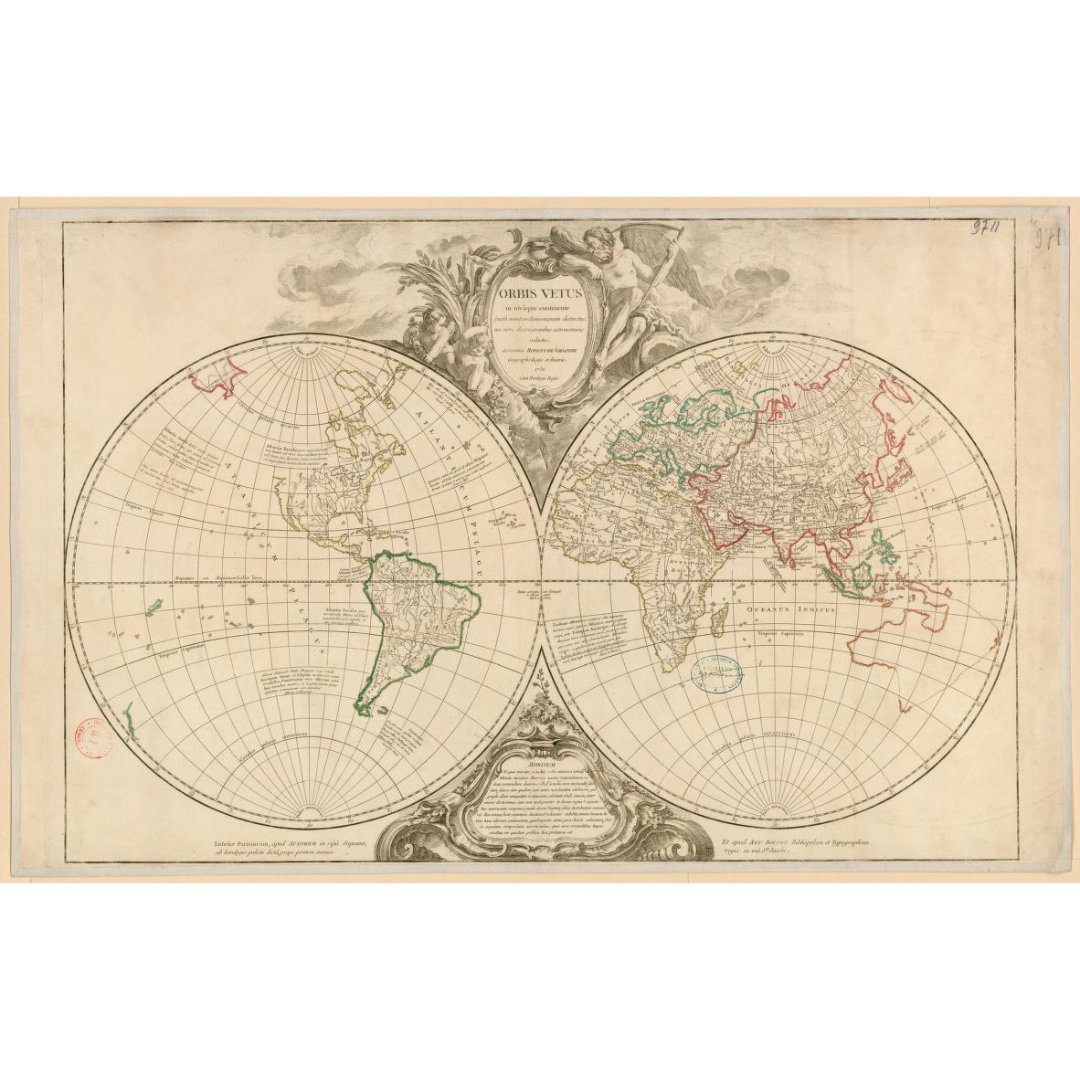


An elegant 1752 “Old World” map issued in Paris, synthesizing mid-18th-century knowledge of Europe, Asia, and Africa. Compiled by Didier Robert de Vaugondy and published with Antoine Boudet, it captures the transitional state of geography just before later discoveries reshaped global cartography. Notably, it preserves long-held errors—such as the Niger River flowing into Lake Chad and an outdated outline of Australia—while Alaska is absent altogether.
Features / Details
-
Cartographer: Didier Robert de Vaugondy (1723–1786)
-
Publishers (original): Didier Robert de Vaugondy; Antoine Boudet
-
Place & Date: Paris, 1752
-
Regions Covered: Old World (Europe, Asia, Africa)
-
Notable Historical Details: Niger shown debouching into Lake Chad; Australia drawn to a 17th-century model; Alaska missing
-
Scale (original): about 1:71,000,000
-
Physical Details (original): 1 map; contours in color; 47.5 × 71 cm
-
Language: Latin
-
Collection Note: Associated with the d’Anville Collection (Bibliothèque nationale de France)
Source & Rights
Image courtesy of the Library of Congress.
You will receive a newly made, high-resolution fine-art print of this historical map (not the original artifact).