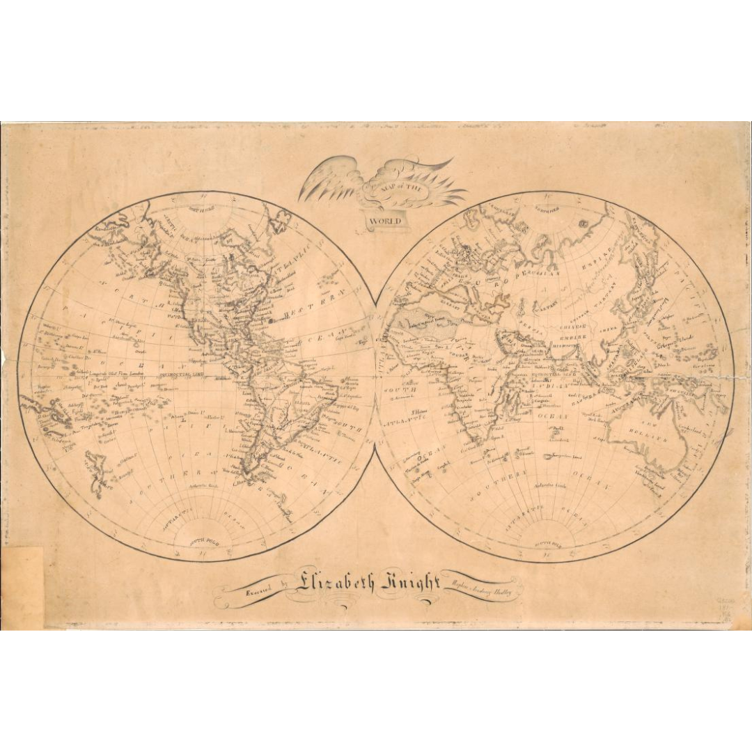


An early 19th-century world map attributed to Elizabeth Knight of Hadley, Massachusetts, dated between 1810 and 1820. Relief is shown with shaded landforms, and the title is set within an illustrated eagle—an emblematic American cartouche detail from the period. Though the original sheet shows wear (including a trimmed lower-left corner and later cloth mounting), the design preserves a clear, period view of the globe.
Features / Details
-
Cartographer: Elizabeth Knight (active 1810–1820)
-
Date: c. 1810 (created/published 1810–1820)
-
Place of Publication (original): Hadley, Massachusetts
-
Map Type: World map (early 19th century)
-
Relief: Shading
-
Notable Feature: Title within an eagle illustration (cartouche)
-
Condition Notes (original): Lower-left corner cut away; mounted on cloth
-
Provenance: Gift to the Library of Congress (1957)
Source & Rights
Image courtesy of the Library of Congress.
You will receive a newly made, high-resolution fine-art print of this historical map (not the original artifact).