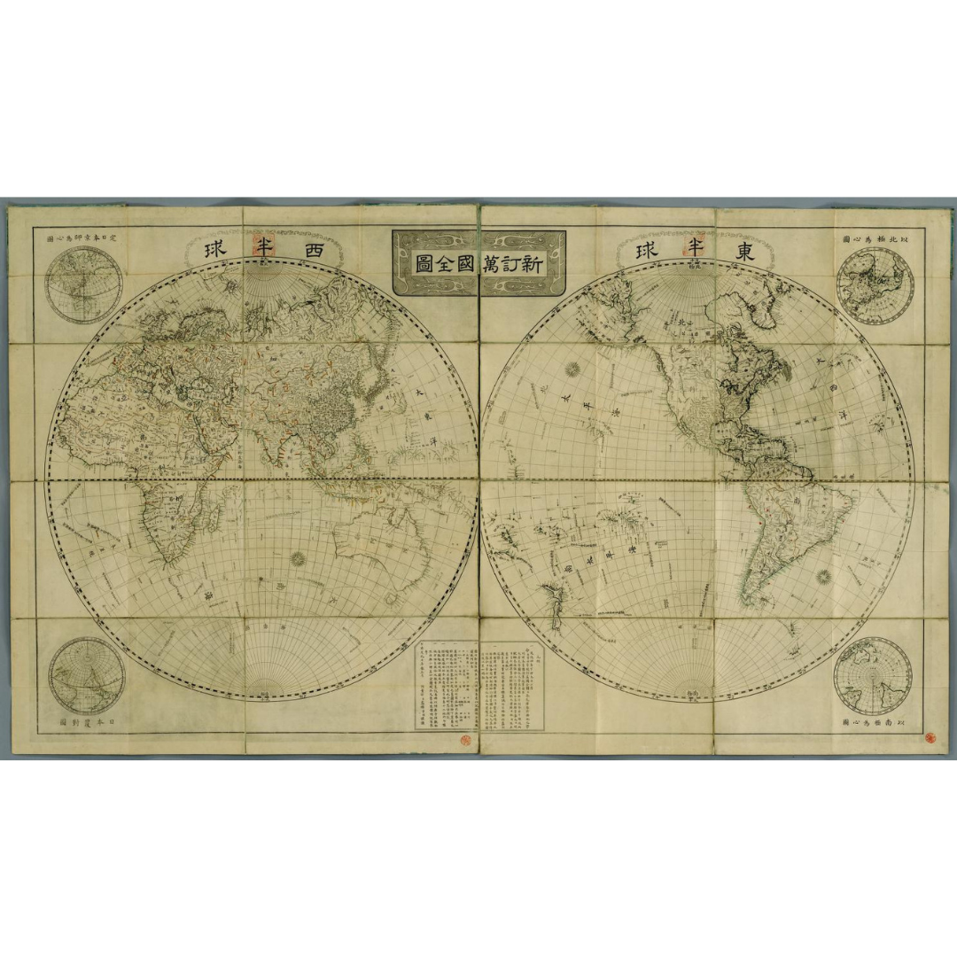


A distinctive Japanese world map created by Takahashi Kageyasu of the shogunate’s astronomy office (Tenmonkata) and etched by Aōdō Denzen in 1816. It inverts Western conventions by placing the Western hemisphere on the right and labeling it the “Eastern” hemisphere, with four corner subhemispheric maps—one centered on Kyōto. The work incorporates new geographic knowledge from the 1809 Mamiya Strait exploration of Sakhalin (Karafuto).
Features / Details
-
Creator/Cartographer: Takahashi Kageyasu (1785–1829)
-
Etcher: Aōdō Denzen (1748–1822)
-
Contributors: Hazama Shigetomi (1756–1816), astronomer; Baba Sajūrō (1787–1822), Dutch interpreter
-
Date: 1816 (confirmed by contemporary sources)
-
Map Type: World map with hemispheric layout; subhemispheric corner maps (upper-left centered on Kyōto)
-
Orientation/Convention: Western hemisphere shown at right and named the “Eastern” hemisphere
-
Sources of Information: Includes data from the 1809 Mamiya Strait crossing (Sakhalin/Karafuto survey)
-
Physical Details (original): 2 sheets; 113 × 98 cm; originally printed in 16 parts and mounted as one sheet (this copy later divided in two)
-
Language: Japanese
-
Publication Info (original): Place and publisher not identified
-
Provenance: Original resource at the National Diet Library
Source & Rights
Image courtesy of the Library of Congress.
You will receive a newly made, high-resolution fine-art print of this historical map (not the original artifact).