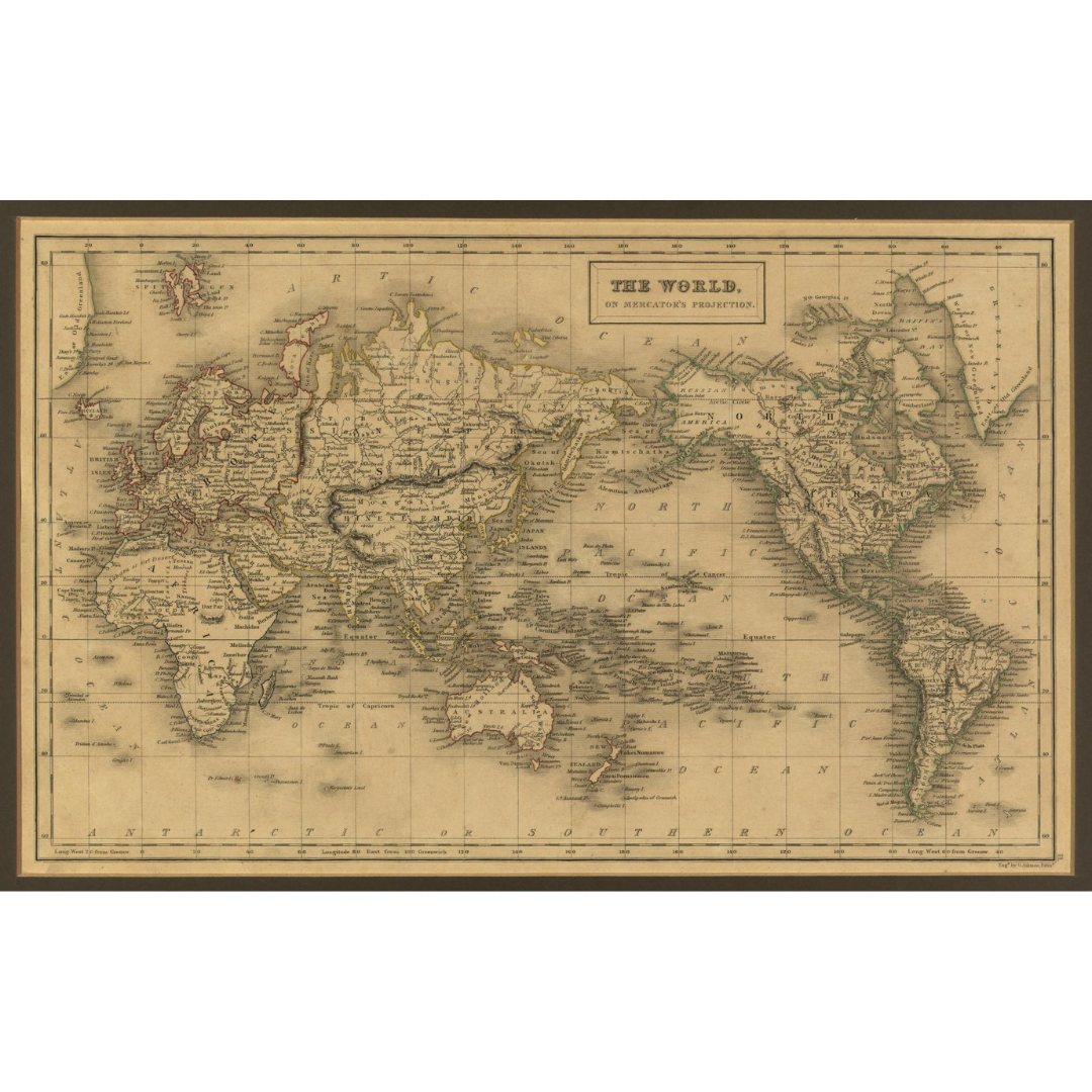


A classic 1840 world map from A & C Black’s General Atlas of the World, engraved by Scottish printer George Aikman. Drawn on Mercator’s projection, it reflects the era’s geographic knowledge: coastlines are largely established, while the poles and many continental interiors remain incomplete or conjectural.
Features / Details
-
Date: 1840
-
Projection: Mercator
-
Map Type: World map from General Atlas of the World
-
Publisher (original): A & C Black
-
Engraver: George Aikman (1788–1865)
-
Geographic Notes: Antarctic omitted; Arctic details incomplete
-
Interior Detail (c. 1840): Largely speculative in Central Asia, South America, the western United States, Australia, and especially Africa
-
Coloring: Continents outlined in different colors (later editions used solid fills)
Source & Rights
Image courtesy of the Library of Congress.
You will receive a newly made, high-resolution fine-art print of this historical map (not the original artifact).